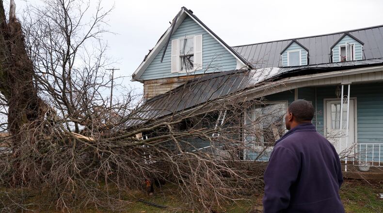
According to a statement, the tornado was classified as an EF1, with an estimated maximum wind speed of 90-95 mph.
No injuries were reported.
In Clark County, Pike Twp. resident Jerome Thomas said he was outside with his son when they saw the storm forming.
He and his two children went into their home’s bathroom for safety, and Thomas said it sounded like a freight train outside.
“All we were saying in there was ‘Jesus, Jesus, Jesus,’” he said.
The tornado began at about 3:19 p.m., touching down near Ayres Pike, about three miles south by southeast of Christiansburg.
It then traveled 2.3 miles over the course of about two minutes, with the last noted damage occurring just north of Ballentine Pike and east of Ansbaugh Road, about three miles northwest of North Hampton, the NWS said.
Damage from the tornado included a barn being destroyed, multiple trees being uprooted and large branches being snapped off others. It also dealt some damage to homes, ripping siding off one home, dealing mild to severe roof damage to multiple houses and caving in one garage door.
The NWS also thanked the Clark County Emergency Management Agency for its coordination with the damage survey.
The NWS also confirmed a tornado touched down Monday in Butler County northwest of Middletown.
Several southwest Ohio communities faced tornado warnings Monday afternoon as severe weather struck.
The agency conducted storm surveys in Butler and Clark counties Tuesday.
It’s not clear if it was two separate tornadoes or the same tornado in Butler and Clark counties. Final assessments with the survey results are expected to be released late Tuesday.
NWS also conducted a storm survey in Orient in Pickaway County on Tuesday and confirmed a tornado touched down near Orient on Monday.
The Monday tornado was Clark County’s 29th since 1960, NWS records show.
The 17 tornadoes since 2007 have all been EF0 or EF1, according to the NWS.
Credit: Bill Lackey
Credit: Bill Lackey
Tornadoes are rated using six damage categories.
Wind speeds are measured on the Enhanced Fujita scale, implemented in February 2007, according to the NWS.
EF-0
- Estimated wind speeds: 65 to 85 mph
- Observations: Minor damage. Winds will pull siding or gutters off homes, broken tree branches and shallow-rooted trees pushed over.
EF-1
- Estimated wind speeds: 86 to 110 mph
- Observations: Moderate damage. Roofs stripped of shingles. Mobile homes overturned or damaged. Broken glass to windows or other glass.
EF-2
- Estimated wind speeds: 111 to 135
- Observations: Considerable damage. Roofs torn off well-constructed homes. Mobile homes completely destroyed. Large trees snapped or uprooted. Cars lifted off ground.
EF-3
- Estimated wind speeds: 136 to 165 mph
- Observations: Severe damage. Well-constructed homes destroyed. Severe damage to large buildings like shopping malls. Heavy cars lifted off the ground and thrown. Trains overturned.
EF-4
- Estimated wind speeds: 166 to 200 mph
- Observations: Devastating damage. Whole frames of well-constructed homes completely leveled. Cars thrown and small missiles generated
EF-5
- Estimated wind speeds: Over 200 mph
- Observations: Incredible damage. Strong frame houses leveled off foundations and swept away. Car-sized missiles fly through the air over 100 yards. High-rise buildings have significant deformation.
About the Author

